Of course, there are a lot of nice places to go in our grand land, places that are hundreds, even thousands of miles away. I, however, am tethered to a work-a-day life complete with a cubicle and boss. Someday, I will have the money and time to explore the great jumble of places that crowd our continent. For now, I will load the family up into our old Audi wagon and go to the lake.
Lake Champlain is the sixth largest lake in the country. I live only three miles from this massive expanse of water that measures 120 miles long and is, at its widest, 12 miles across. This mighty lake is more than 400ft deep in places and has a total volume of 6.8 quadrillion gallons. That's a lot of water, you could drown in that much water.
Before the advent of modern roads and rails, the lake-which forms a natural border between Vermont and New York-was a highway for natives and later settlers, loggers, traders and such. During colonial times, the lake was of such central and strategic location that it was the birth place of the US Navy. In 1776, troops under the command of Benedict Arnold-a rebel hero whose name would be later marred by betrayal of such severity that among his peers rank Judas and Johnny Damon-built the first U.S. naval fleet at the southern end of Lake Champlain in the town of Whitehall, NY. This fleet later took on a larger British fleet at Valcour Island in order to prevent the British from linking their forces in Canada with their Colonial troops. Though all of Benedict Arnold’s ships would ultimately be burned or sunk, he did succeed in delaying the British from establishing control of the lake and, by doing so, prevented the Redcoats from overwhelming the fledgling American army.
Fascinating, I know, but this road trip has nothing to do with either the Redcoats or Benedict Arnold. What I’m trying to emphasize here is that the lake is rich with history, a history, in fact, that stretches back millions of years. One of the world’s oldest known coral reefs is found on Isle La Motte in Lake Champlain. Isle La Motte, which is about six-miles-long and two-miles-wide, is the northern most island on the lake and has a permanent population of 500 or so residents.
You see, 480 million years ago when this reef formed, Vermont was actually south of the
 equator and under a warm tropical sea. In that lush environment, life flourished allowing for evolution of early ocean organisms. Today, sections of this reef are exposed, revealing vast banks of Paleozoic fossils. Parts of this reef, known as the Chazy Reef, can be found as far north as Newfoundland and as far south as Tennessee, however in the Fisk Quarry on Isle La Motte the reef is exposed and cut open by years of stone cutting. Nelson Fisk, who was Lieutenant Governor of Vermont from 1896 to 1898 and progenitor of the Fiske Family Farm-which today is preserved along with the quarry-falsely marketed the limestone as black and gray marble and sold it to builders in New York, Washington DC and else where.
In fact, Fiske Quarry limestone was used in the construction of the iconic Brooklyn Bridge which spans the East River between the New York Burroughs of Manhattan and Brooklyn. When it was completed in 1883, the Brooklyn Bridge was the largest suspension bridge ever built, its two granite towers-rising above everything else in the skyline-were then the tallest structures in the city. Even today, thought by size it is much smaller than the Delaware Memorial Bridge or even the nearby George Washington Bridge, the Brooklyn Bridge-with its arches, stone buttresses and other Gothic aspects-is grandest in style. Sorry, that was a tangent, but you know how I love bridges.
Now, back to the road. Isle La Motte is accessible from the north east coast of the lake via Route 78 which can be picked up in Swanton, VT. Swanton can be reached by traveling North on I-89 until exit 21 or by traveling north on Route 7.
I enjoy roads that move with the land, so, for my tastes the Interstate is far too straight and removed from the geography. Route 7, however, is perfect for surveying the gentle basin along the lake's edge. This rolling valley, in which the lake is seated, was once submerged under an in-land salt-water sea called the Champlain Sea. This sea, formed 15,000 years ago by the marine inundation that occurred as the glaciers retreated during the last ice age, would have rivaled the Great Lakes in terms of size and depth. In fact, the fossilized remains of whales have been discovered along the shores of this now dry basin.
Along this track of land, which is hemmed to the east by the rugged Green Mountains and to the west by the lake itself, dwell two diverging cultures. One, an urban center with its busy streets, is in sharp contrast to the other, a categorically rural region where cell phone reception is spotty and the most common car is a half-ton truck.
Burlington, Vermont’s largest city, and its associated suburban communities lies on the lake’s edge in Chittenden County. Known locally as the Queen City, Burlington is the industrial and commercial hub of the state. It is also home to the University of Vermont, Champlain College and Burlington College. Another upscale college, Saint Michael's College is only a couple miles away in Colchester, VT. In Burlington you will find a faster pace of things with boutiques and restaurants at every corner. There is an obvious beat to the streets, a vibe that is part hipster, part frat boy and part hippy.
In addition to this youthful culture, major companies such as IBM, Ben and Jerry’s and Burton Snow Boards have set up shop either in Burlingon or close by. The area is also a center for local and federal government operations. In fact, Homeland Security has established several central facilities here. But this is no Manhattan by any means, and, Burlington could only be classified as a city in Vermont, a state of diminutive proportions.
To the north and south of this hub the land is open, vast and mostly undeveloped. It is in these fertile sections of Addison and Franklin counties that the state’s best farms thrive. This is, as my grandmother likes to say, God’s country. Here the roads are lined with barns, hay fields and corn rows that come early September are tall enough to get lost in. Route 7 rolls through all this on its way north to Swanton, which itself is an old mining and farming community.
In Swanton, we point the station wagon west down Route 78. To the right is the Missisquoi River which, like all the rivers in the region, drains into the lake. Ahead, where the river and the lake meet is the new Missisquoi Bay Bridge. The new bridge crosses the lake between Swanton and Alburgh and replaces an old seven-span bascule draw bridge, built in 1938, that was approached on either side by stone causeway.
To the north and south of this hub the land is open, vast and mostly undeveloped. It is in these fertile sections of Addison and Franklin counties that the state’s best farms thrive. This is, as my grandmother likes to say, God’s country. Here the roads are lined with barns, hay fields and corn
 rows that come early September are tall enough to get lost in. Route 7 rolls through all this on its way north to Swanton, which itself is an old mining and farming community.
In Swanton, we point the station wagon west down Route 78. To the right is the Missisquoi River which, like all the rivers in the region, drains into the lake. Ahead, where the river and the lake meet is the new Missisquoi Bay Bridge. The new bridge crosses the lake between Swanton and Alburgh and replaces an old seven-span bascule draw bridge, built in 1938, that was approached on either side by stone causeway.
This bridge is part of a two-bridge link to New York. The other bridge in the system is the Rouse’s Point Bridge which connects the New York town of the same name to Alburgh, VT. The only other crossing by road is via the Champlain Bridge located between Chimney Point, VT and Crown Point, NY at the southern extreme of the lake.
The Vermont Agency of Transportation determined in 2001 that the deteriorating Missisquoi Bay Bridge needed to be replaced. The bridge’s lane widths were too narrow to safely accommodate modern traffic; which is a mix of cars, commercial trucking and bicycles. The drawbridge itself had been welded shut in 1988 because of deck deterioration, prohibiting boats over 13 feet in height from passing beneath it.
The new bridge, a 3,600-foot 23-span crossing, is the largest bridge in Vermont and was completed in May of this year at a cost $41.2 million. That’s a lot of money, but, most of it was federally funded. Thank you, George.
On the far side of the bridge is the small town of Alburgh. This town, named for Revolutionary War hero Ethan Allen, lies on a tongue of land that descends from Canada. This peninsula - Like Point Roberts, WA, Elm Point and the Northwest Angle, MN - is one of a few places that are part of the continental United States that are not connected by land to any other part of our country.
In Alburgh, route 78 and Route 2 meet at a four-way intersection, each direction leading to an equally enticing destination. Turning right would lead to downtown Alburgh and eventually New York or Canada. And going left would track us South on Route 2 which runs down Grand Isle County before turning back inland toward Burlington. We go straight and head down a road known simply as Truck Route. This road terminates at the West Shore Road where we turn left to head south and toward Route 129 and Isle La Motte.
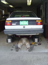
To the right is the broad lake. It is all sparkles in the mid-day sun. So beautiful, in fact, that I do not loose my cool when the exhaust starts to leak and the Audi begins to sound more like a Panzer than a wagen (pronounced “vagan”). After all, it’s nothing that a fist full of money can’t fix, and, as every Vermonter knows, loud cars drive the same as quiet ones.
Along our left are old farms with weathered barns and houses intermingled with puffed-up, new-built yuppie digs. It is a strange juxtaposition that has become common in the area as struggling dairy farmers sell off lots to land-hungry developers. These developers then build pricey homes that only out-of-staters can afford. And in this strange way the population is turned over so that outsiders outnumber the natives. Here in Alburgh, the transition has just begun. Elsewhere, in places like Williston and Shelburne, the state is beginning to look more like Massachusetts and less like Vermont. In a few more decades the transition will be complete. The social landscape is changing and it saddens me for it is my heritage that is being displaced by a much wealthier and more powerful social group.
We take the crossing to Isle La Motte - which is an old, stone causeway - and head down Main St which is also Route 129. The landscape on this little island is pristine. Small farms and old houses with grand porches dominate an otherwise natural countryside. There is a vineyard, an orchard and several dairy farms replete with happy and idle Holsteins. I spot some wild turkeys in one field and twice we are forced to slow as brown rabbits dart across the road.
The road narrows and eventually turns to dirt. I loose track of the scenery as I focus my attention on dodging the suspension smashing pot-holes that seem to abound everywhere.
Finally, we turn a bend and the entrance to the quarry materializes. The Fiske Quarry, set back behind a thin veil of trees, is not visible from the road. There is a small parking-area in front of the entrance which is marked by a wooden sign. From the road, it is an easy walk, flat and level enough for a grand ma to handle. Of course, my 93-year-old grand ma (despite the protests of her doctors) still lifts weights and goes for long walks.
The floor of the quarry consists of textured black and gray limestone. To the far left rises a cliff of stratified stone. At the foot of this cliff lies a lush water-filled depression. A sharp eye will notice the holes drilled in the cliff face during mining operations that, after an 80 year lull, re-started in 1995. This re-newed mining venture was quickly shutdown by state officials in order to protect the historic site. Today, the quarry is owned by the Isle La Motte Preserve Trust with the intent that the fossils will be preserved forever.
And, there are many fossils captured in these ancient stones, in fact, the limestone itself is a fossil, a mash of sediment, formed when dead organisms sank to the ocean’s floor and compacted into stone over millions of years. Look close to spot the larger remains of pre-historic sea creatures that once dwelt in this shallow ocean reef. We spot several gastropods, they were the spiral-shelled snails of the ancient world. We also see a few crinoids, which are stalked sea animals that look like flowers with long feathery pedals. What we find though are the ridged remains of the stalks. There are many more species preserved here but they are lost to us, for, there are also living creatures to see.
The lush water-filled sections of the quarry teem with turtles and frogs that sun themselves on stumps and rocks. In the trees surrounding the quarry are birds of every category. Observing the mix of past and present in this place makes it obvious that the world is a tremendous symphony of systems and cycles running in perfect balance, a sort of perpetual motion machine. Scientist maintain that when this reef was active the world was a warmer place with an atmosphere rich in carbon dioxide.
The Vermont Agency of Transportation determined in 2001 that the deteriorating Missisquoi Bay Bridge needed to be replaced. The bridge’s lane widths were too narrow to safely accommodate modern traffic; which is a mix of cars, commercial trucking and bicycles. The drawbridge itself had been welded shut in 1988 because of deck deterioration, prohibiting boats over 13 feet in height from passing beneath it.
The new bridge, a 3,600-foot 23-span crossing, is the largest bridge in Vermont and was
 completed in May of this year at a cost $41.2 million. That’s a lot of money, but, most of it was federally funded. Thank you, George.
On the far side of the bridge is the small town of Alburgh. This town, named for Revolutionary War hero Ethan Allen, lies on a tongue of land that descends from Canada. This peninsula - Like Point Roberts, WA, Elm Point and the Northwest Angle, MN - is one of a few places that are part of the continental United States that are not connected by land to any other part of our country.

In Alburgh, route 78 and Route 2 meet at a four-way intersection, each direction leading to an equally enticing destination. Turning right would lead to downtown Alburgh and eventually New York or Canada. And going left would track us South on Route 2 which runs down Grand Isle County before turning back inland toward Burlington. We go straight and head down a road known simply as Truck Route. This road terminates at the West Shore Road where we turn left to head south and toward Route 129 and Isle La Motte.
To the right is the broad lake. It is all sparkles in the mid-day sun. So beautiful, in fact, that I do not loose my cool when the exhaust starts to leak and the Audi begins to sound more like a Panzer than a wagen (pronounced “vagan”). After all, it’s nothing that a fist full of money can’t fix, and, as every Vermonter knows, loud cars drive the same as quiet ones.
Along our left are old farms with weathered barns and houses intermingled with puffed-up, new-built yuppie digs. It is a strange juxtaposition that has become common in the area as struggling dairy farmers sell off lots to land-hungry developers. These developers then build pricey homes that only out-of-staters can afford. And in this strange way the population is turned over so that outsiders outnumber the natives. Here in Alburgh, the transition has just begun. Elsewhere, in places like Williston and Shelburne, the state is beginning to look more like Massachusetts and less like Vermont. In a few more decades the transition will be complete. The social landscape is changing and it saddens me for it is my heritage that is being displaced by a much wealthier and more powerful social group.
We take the crossing to Isle La Motte - which is an old, stone causeway - and head down Main St which is also Route 129. The landscape on this little island is pristine. Small farms and old houses with grand porches dominate an otherwise natural countryside. There is a vineyard, an orchard and several dairy farms replete with happy and idle Holsteins. I spot some wild turkeys in one field and twice we are forced to slow as brown rabbits dart across the road.
The road narrows and eventually turns to dirt. I loose track of the scenery as I focus my
 attention on dodging the suspension smashing pot-holes that seem to abound everywhere.
Finally, we turn a bend and the entrance to the quarry materializes. The Fiske Quarry, set back
 behind a thin veil of trees, is not visible from the road. There is a small parking-area in front of the entrance which is marked by a wooden sign. From the road, it is an easy walk, flat and level enough for a grand ma to handle. Of course, my 93-year-old grand ma (despite the protests of her doctors) still lifts weights and goes for long walks.
The floor of the quarry consists of textured black and gray limestone. To the far left rises a cliff of stratified stone. At the foot of this cliff lies a lush water-filled depression. A sharp eye will notice the holes drilled in the cliff face during mining operations that, after an 80 year lull, re-started in 1995. This re-newed mining venture was quickly shutdown by state officials in order to protect the historic site. Today, the quarry is owned by the Isle La Motte Preserve Trust with the intent that the fossils will be preserved forever.
And, there are many fossils captured in these ancient stones, in fact, the limestone itself is a
 fossil, a mash of sediment, formed when dead organisms sank to the ocean’s floor and compacted into stone over millions of years. Look close to spot the larger remains of pre-historic sea creatures that once dwelt in this shallow ocean reef. We spot several gastropods, they were the spiral-shelled snails of the ancient world. We also see a few crinoids, which are stalked sea animals that look like flowers with long feathery pedals. What we find though are the ridged remains of the stalks. There are many more species preserved here but they are lost to us, for, there are also living creatures to see.
The lush water-filled sections of the quarry teem with turtles and frogs that sun themselves on
 stumps and rocks. In the trees surrounding the quarry are birds of every category. Observing the mix of past and present in this place makes it obvious that the world is a tremendous symphony of systems and cycles running in perfect balance, a sort of perpetual motion machine. Scientist maintain that when this reef was active the world was a warmer place with an atmosphere rich in carbon dioxide.
 Perhaps, our modern warming trend is part of the cycle. Perhaps the purpose of our specious is to bring about a change that will lay the ground work for that which will come after us. If this is so, then our race would surely die during the transition, but, is it not arrogant to think that we, above all other organisms, shall live forever.
No comments:
Post a Comment